 Translate
Translate
Translate

| Colorado Modeling Guideline Supplemental Guidance, Forms, and Information Meteorological Data Maps, Figures, Tables Federal Modeling Support On-Line Training |
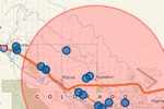 Queried Sources of Air Pollution Map |
This webpage presents current air quality permit modeling guidance for estimating impacts from stationary sources of air pollution.
For general permitting questions, contact the Stationary Sources Program. Contact monitoring or modeling staff in the Technical Services Program for monitoring or modeling questions, respectively.
Completeness Checklist for Modeling Submittals
FAQs on Air Quality Modeling Data and Techniques
The Technical Services Program of the Air Pollution Control Division has data from current and historic meteorological towers in Colorado that are suitable for use in regulatory models. Contact the Division for data. Division approval should be obtained on a case-by-case basis before meteorological datasets are used for regulatory (e.g., air permit) modeling.

